
Thank you for supporting this site ❤️
Make a donation
Make a donation
Kiulap topographic map
Click on the map to display elevation.
Thank you for supporting this site ❤️
Make a donation
Make a donation
About this map
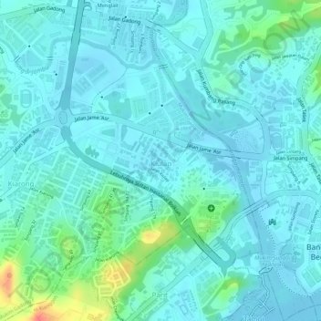
Name: Kiulap topographic map, elevation, terrain.
Location: Kiulap, Mukim Gadong B, Brunei-Muara District, BE1518, Brunei (4.88843 114.92129 4.90591 114.93535)
Average elevation: 12 m
Minimum elevation: -2 m
Maximum elevation: 58 m
Thank you for supporting this site ❤️
Make a donation
Make a donation
Other topographic maps
Click on a map to view its topography, its elevation and its terrain.