
Arquennes topographic map
Interactive map
Click on the map to display elevation.
About this map
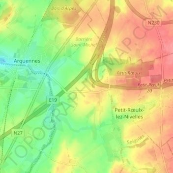
Name: Arquennes topographic map, elevation, terrain.
Location: Arquennes, Seneffe, Soignies, Hainaut, Wallonie, 7181, Belgique (50.54196 4.27635 50.58196 4.31635)
Average elevation: 126 m
Minimum elevation: 89 m
Maximum elevation: 160 m
Other topographic maps
Click on a map to view its topography, its elevation and its terrain.