
Hoshangābād topographic map
Interactive map
Click on the map to display elevation.
About this map
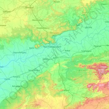
Name: Hoshangābād topographic map, elevation, terrain.
Location: Hoshangābād, Hoshangabad, Madhya Pradesh, 461111, India (22.01031 77.11093 23.29031 78.39093)
Average elevation: 427 m
Minimum elevation: 263 m
Maximum elevation: 1,294 m
Other topographic maps
Click on a map to view its topography, its elevation and its terrain.
Shivpuri
Shivpuri, Shivpuri district, Madhya Pradesh, India
Average elevation: 332 m
Sagar
India > Madhya Pradesh > Sagar
Sagar, Sagar Tahsil, Sagar, Madhya Pradesh, 470001, India
Average elevation: 515 m
Khargone
India > Madhya Pradesh > Khargone > Khargone
Khargone, Khargone Tahsil, Khargone, Madhya Pradesh, 451001, India
Average elevation: 284 m