
Make a donation
Lake Naverone topographic map
Click on the map to display elevation.
Make a donation
About this map
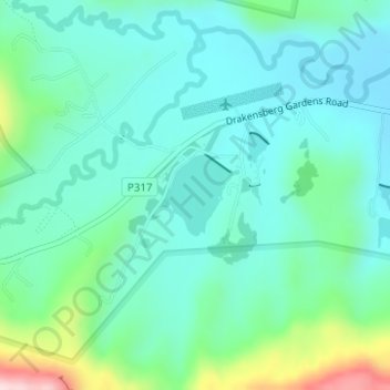
Name: Lake Naverone topographic map, elevation, terrain.
Average elevation: 1,712 m
Minimum elevation: 1,638 m
Maximum elevation: 1,975 m
Make a donation
Other topographic maps
Click on a map to view its topography, its elevation and its terrain.
Ndlovini
South Africa > KwaZulu-Natal > Sisonke District Municipality > Kwa Sani Local Municipality
Average elevation: 1,962 m
Umzimkulu River
South Africa > KwaZulu-Natal > Sisonke District Municipality > Kwa Sani Local Municipality
Average elevation: 1,438 m
Umzimkulu
South Africa > KwaZulu-Natal > Sisonke District Municipality > Kwa Sani Local Municipality
Average elevation: 1,491 m
Bergview
South Africa > KwaZulu-Natal > Sisonke District Municipality > Kwa Sani Local Municipality
Average elevation: 1,578 m
Make a donation
Kenmo Lake
South Africa > KwaZulu-Natal > Sisonke District Municipality > Kwa Sani Local Municipality
Average elevation: 1,533 m