
West Peoria topographic map
Interactive map
Click on the map to display elevation.
About this map
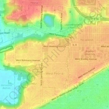
Name: West Peoria topographic map, elevation, terrain.
Location: West Peoria, Peoria County, Illinois, 61604, United States (40.68431 -89.66133 40.71077 -89.62297)
Average elevation: 174 m
Minimum elevation: 139 m
Maximum elevation: 197 m