
Valkenswaard topographic map
Interactive map
Click on the map to display elevation.
About this map
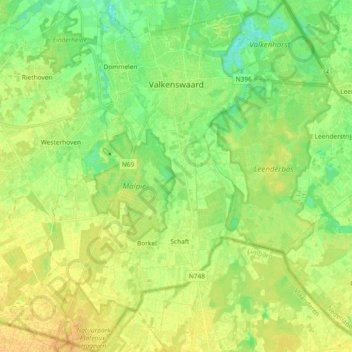
Name: Valkenswaard topographic map, elevation, terrain.
Location: Valkenswaard, Brabant-Septentrional, Pays-Bas (51.26228 5.38780 51.37834 5.52718)
Average elevation: 28 m
Minimum elevation: 15 m
Maximum elevation: 41 m