
Thank you for supporting this site ❤️
Make a donation
Make a donation
Mount Chase topographic map
Click on the map to display elevation.
Thank you for supporting this site ❤️
Make a donation
Make a donation
About this map
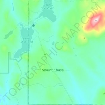
Name: Mount Chase topographic map, elevation, terrain.
Location: Mount Chase, Penobscot County, Maine, United States (46.03523 -68.56357 46.12513 -68.43227)
Average elevation: 288 m
Minimum elevation: 196 m
Maximum elevation: 735 m
Thank you for supporting this site ❤️
Make a donation
Make a donation
Other topographic maps
Click on a map to view its topography, its elevation and its terrain.
Thank you for supporting this site ❤️
Make a donation
Make a donation
Thank you for supporting this site ❤️
Make a donation
Make a donation