
Ha 'Matsa topographic map
Interactive map
Click on the map to display elevation.
About this map
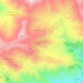
Name: Ha 'Matsa topographic map, elevation, terrain.
Location: Ha 'Matsa, Mohale's Hoek District, Lesotho (-29.94709 28.39142 -29.90709 28.43142)
Average elevation: 2,360 m
Minimum elevation: 1,811 m
Maximum elevation: 2,756 m
Other topographic maps
Click on a map to view its topography, its elevation and its terrain.
Bakenkop
Lesotho > Mohale's Hoek District
Bakenkop, Mohale's Hoek District, Lesotho
Average elevation: 1,829 m
Riet Vlei
Lesotho > Mohale's Hoek District > Riet Vlei
Riet Vlei, Mohale's Hoek District, Lesotho
Average elevation: 1,535 m