
Naas topographic map
Interactive map
Click on the map to display elevation.
About this map
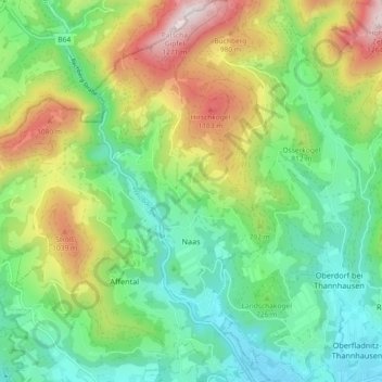
Name: Naas topographic map, elevation, terrain.
Location: Naas, Bezirk Weiz, Styria, 8160, Austria (47.22289 15.53281 47.28504 15.62074)
Average elevation: 745 m
Minimum elevation: 472 m
Maximum elevation: 1,271 m