
Dumka topographic map
Interactive map
Click on the map to display elevation.
About this map
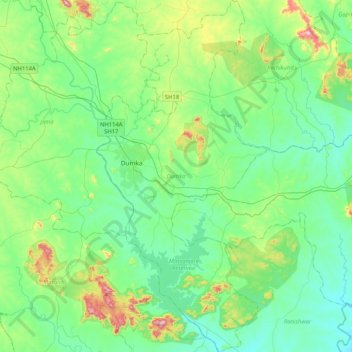
Name: Dumka topographic map, elevation, terrain.
Location: Dumka, Jharkhand, India (24.06555 87.20780 24.44199 87.40710)
Average elevation: 160 m
Minimum elevation: 74 m
Maximum elevation: 459 m
Other topographic maps
Click on a map to view its topography, its elevation and its terrain.
Maluti
India > Jharkhand > Shikaripara
Maluti, Shikaripara, Dumka District, Jharkhand, India
Average elevation: 56 m