
Whistler Resort Municipality topographic map
Interactive map
Click on the map to display elevation.
About this map
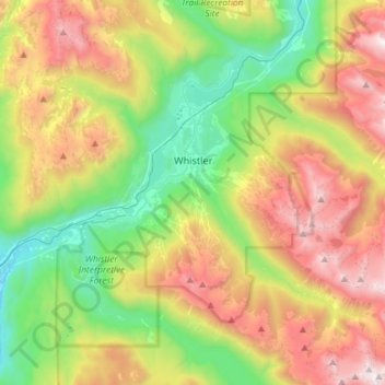
Name: Whistler Resort Municipality topographic map, elevation, terrain.
Average elevation: 1,343 m
Minimum elevation: 499 m
Maximum elevation: 2,607 m
Other topographic maps
Click on a map to view its topography, its elevation and its terrain.
Squamish
Kanada > Britisch-Kolumbien > Squamish-Lillooet Regional District
Squamish, Squamish-Lillooet Regional District, Britisch-Kolumbien, Kanada
Average elevation: 844 m