
Zambezi District topographic map
Interactive map
Click on the map to display elevation.
About this map
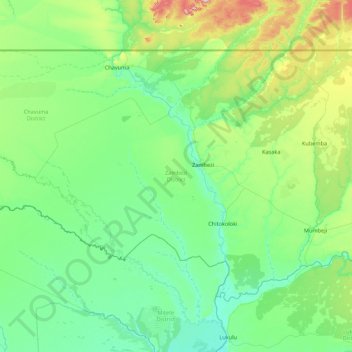
Name: Zambezi District topographic map, elevation, terrain.
Location: Zambezi District, North-Western Province, Zambia (-14.20534 22.00039 -13.00014 23.73644)
Average elevation: 1,082 m
Minimum elevation: 1,022 m
Maximum elevation: 1,429 m
Other topographic maps
Click on a map to view its topography, its elevation and its terrain.
Mwinilunga
Zambia > North-Western Province
Mwinilunga, Mwinilunga District, North-Western Province, Zambia
Average elevation: 1,345 m