
Schwanthalerhöhe topographic map
Interactive map
Click on the map to display elevation.
About this map
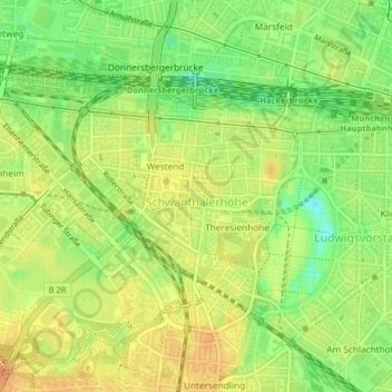
Name: Schwanthalerhöhe topographic map, elevation, terrain.
Location: Schwanthalerhöhe, Múnich, Baviera, 80339, Alemania (48.12637 11.52597 48.14285 11.54979)
Average elevation: 529 m
Minimum elevation: 507 m
Maximum elevation: 545 m
Other topographic maps
Click on a map to view its topography, its elevation and its terrain.
Stadtbezirk 03 Maxvorstadt
Stadtbezirk 03 Maxvorstadt, Múnich, Alta Baviera, Baviera, Alemania
Average elevation: 520 m
Bezirksteil Hasenbergl-Lerchenau Ost
Bezirksteil Hasenbergl-Lerchenau Ost, Stadtbezirk 24 Feldmoching-Hasenbergl, Múnich, Alta Baviera, Baviera, Alemania
Average elevation: 499 m