
Buttes topographic map
Interactive map
Click on the map to display elevation.
About this map
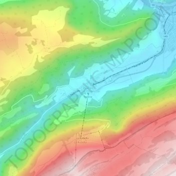
Name: Buttes topographic map, elevation, terrain.
Location: Buttes, Val-de-Travers, Neuchâtel, 2115, Suisse (46.86746 6.53135 46.90746 6.57135)
Average elevation: 1,042 m
Minimum elevation: 742 m
Maximum elevation: 1,455 m