
Aschau topographic map
Interactive map
Click on the map to display elevation.
About this map
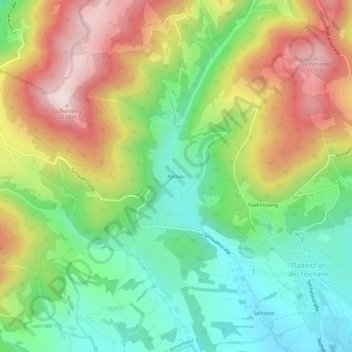
Name: Aschau topographic map, elevation, terrain.
Average elevation: 885 m
Minimum elevation: 642 m
Maximum elevation: 1,228 m
Other topographic maps
Click on a map to view its topography, its elevation and its terrain.
Teichalm
Autriche > Styrie > Bezirk Weiz > Fladnitz an der Teichalm > Teichalm
Teichalm, Fladnitz an der Teichalm, Bezirk Weiz, Styrie, 8163, Autriche
Average elevation: 1,217 m