
Thank you for supporting this site ❤️
Make a donation
Make a donation
Fairfield Dam topographic map
Click on the map to display elevation.
Thank you for supporting this site ❤️
Make a donation
Make a donation
About this map
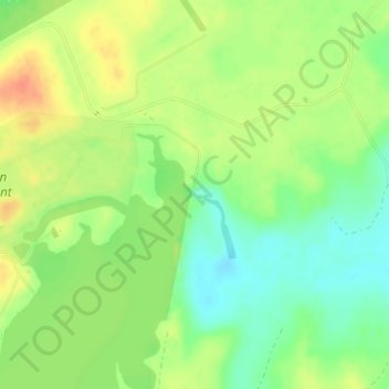
Name: Fairfield Dam topographic map, elevation, terrain.
Location: Fairfield Dam, Freestone County, Texas, United States (31.82168 -96.04056 31.82178 -96.04046)
Average elevation: 95 m
Minimum elevation: 73 m
Maximum elevation: 118 m
Thank you for supporting this site ❤️
Make a donation
Make a donation