
El Socorro topographic map
Interactive map
Click on the map to display elevation.
About this map
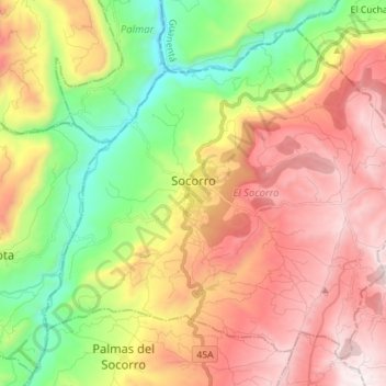
Name: El Socorro topographic map, elevation, terrain.
Location: El Socorro, Comunera, Santander, Colombia (6.40599 -73.31656 6.52579 -73.17573)
Average elevation: 1,229 m
Minimum elevation: 607 m
Maximum elevation: 1,896 m