
Thank you for supporting this site ❤️
Make a donation
Make a donation
Lumbulumbu topographic map
Click on the map to display elevation.
Thank you for supporting this site ❤️
Make a donation
Make a donation
About this map
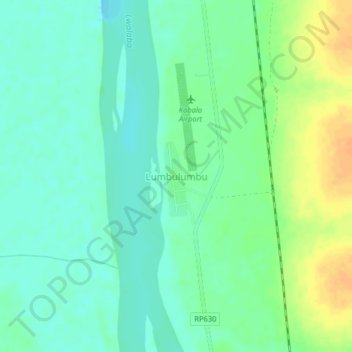
Name: Lumbulumbu topographic map, elevation, terrain.
Location: Lumbulumbu, Tanganyika, Democratic Republic of the Congo (-6.11140 26.89609 -6.07140 26.93609)
Average elevation: 559 m
Minimum elevation: 547 m
Maximum elevation: 579 m
Thank you for supporting this site ❤️
Make a donation
Make a donation
Other topographic maps
Click on a map to view its topography, its elevation and its terrain.