
Thank you for supporting this site ❤️
Make a donation
Make a donation
Port Sorell topographic map
Click on the map to display elevation.
Thank you for supporting this site ❤️
Make a donation
Make a donation
About this map
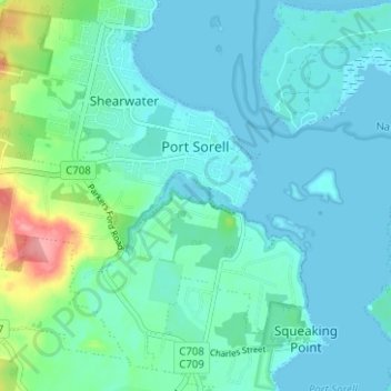
Name: Port Sorell topographic map, elevation, terrain.
Location: Port Sorell, Latrobe, Tasmania, 7307, Australia (-41.19202 146.50677 -41.15024 146.56934)
Average elevation: 16 m
Minimum elevation: -2 m
Maximum elevation: 92 m
Thank you for supporting this site ❤️
Make a donation
Make a donation