
Thank you for supporting this site ❤️
Make a donation
Make a donation
Līhau topographic map
Click on the map to display elevation.
Thank you for supporting this site ❤️
Make a donation
Make a donation
About this map
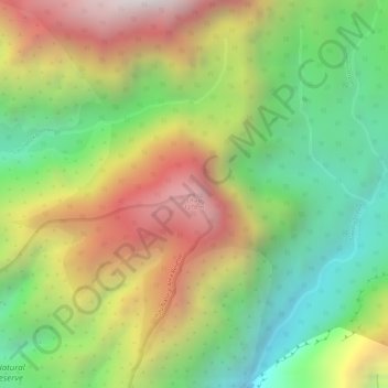
Name: Līhau topographic map, elevation, terrain.
Location: Līhau, Maui County, Hawaii, United States (20.85164 -156.59838 20.85174 -156.59828)
Average elevation: 759 m
Minimum elevation: 229 m
Maximum elevation: 1,356 m
Thank you for supporting this site ❤️
Make a donation
Make a donation