
Thank you for supporting this site ❤️
Make a donation
Make a donation
Whiteriver topographic map
Click on the map to display elevation.
Thank you for supporting this site ❤️
Make a donation
Make a donation
About this map
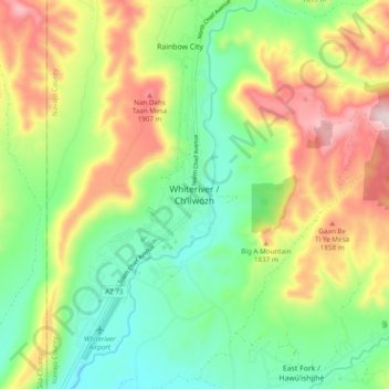
Name: Whiteriver topographic map, elevation, terrain.
Location: Whiteriver, Navajo County, Arizona, 85941, United States (33.79699 -110.00427 33.87699 -109.92427)
Average elevation: 1,701 m
Minimum elevation: 1,513 m
Maximum elevation: 1,994 m
Thank you for supporting this site ❤️
Make a donation
Make a donation
Other topographic maps
Click on a map to view its topography, its elevation and its terrain.
Three Sisters
United States > Arizona > Navajo County
The area is part of the Colorado Plateau. The elevation of the valley floor ranges from 5,000 to 6,000 feet (1,500 to 1,800 m) above sea level. The floor is largely siltstone of the Cutler Group, or sand derived from it, deposited by the meandering rivers that carved the valley. The valley's vivid red color…
Average elevation: 1,664 m