
Alpine Shire topographic map
Click on the map to display elevation.
About this map
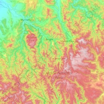
Name: Alpine Shire topographic map, elevation, terrain.
Location: Alpine Shire, Victoria, Australia (-37.27555 146.56645 -36.39270 147.39226)
Average elevation: 801 m
Minimum elevation: 155 m
Maximum elevation: 1,969 m
Other topographic maps
Click on a map to view its topography, its elevation and its terrain.