
Chetouane Belaila topographic map
Interactive map
Click on the map to display elevation.
About this map
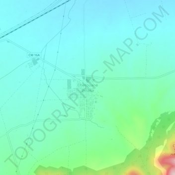
Name: Chetouane Belaila topographic map, elevation, terrain.
Location: Chetouane Belaila, daïra Ben Badis, Sidi Bel Abbès, RADP (34.93226 -0.85594 34.97226 -0.81594)
Average elevation: 712 m
Minimum elevation: 656 m
Maximum elevation: 956 m