
Refuge des Bouillouses topographic map
Interactive map
Click on the map to display elevation.
About this map
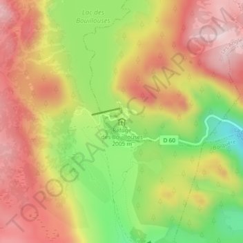
Name: Refuge des Bouillouses topographic map, elevation, terrain.
Average elevation: 2,053 m
Minimum elevation: 1,862 m
Maximum elevation: 2,202 m
Other topographic maps
Click on a map to view its topography, its elevation and its terrain.
Étang de la Balmette
France > Occitanie > Pyrénées-Orientales > Les Angles
Étang de la Balmette, Les Angles, Prades, Pyrénées-Orientales, Occitanie, France métropolitaine, 66210, France
Average elevation: 2,181 m