
Dolores County topographic map
Interactive map
Click on the map to display elevation.
About this map
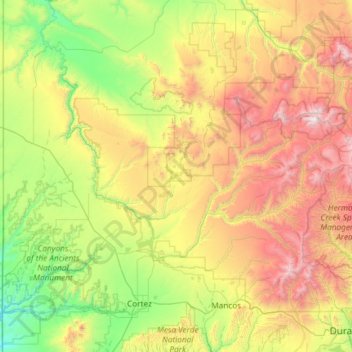
Name: Dolores County topographic map, elevation, terrain.
Location: Dolores County, Colorado, Vereinigte Staaten von Amerika (37.48072 -109.04348 37.89640 -107.86155)
Average elevation: 2,385 m
Minimum elevation: 1,473 m
Maximum elevation: 4,265 m
Other topographic maps
Click on a map to view its topography, its elevation and its terrain.
Mount Wilson
Vereinigte Staaten von Amerika > Colorado > Dolores County
Mount Wilson, Dolores County, Colorado, Vereinigte Staaten von Amerika
Average elevation: 3,892 m