
Joubertina topographic map
Click on the map to display elevation.
About this map
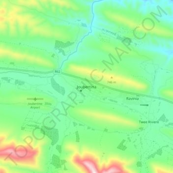
Name: Joubertina topographic map, elevation, terrain.
Average elevation: 593 m
Minimum elevation: 404 m
Maximum elevation: 1,048 m
Other topographic maps
Click on a map to view its topography, its elevation and its terrain.
Churchill Dam
South Africa > Eastern Cape > Sarah Baartman District Municipality > Kou-Kamma Local Municipality
Average elevation: 230 m
Kou-Kamma Local Municipality
South Africa > Eastern Cape > Sarah Baartman District Municipality > Kou-Kamma Local Municipality
Average elevation: 415 m