
Spion Kop topographic map
Interactive map
Click on the map to display elevation.
About this map
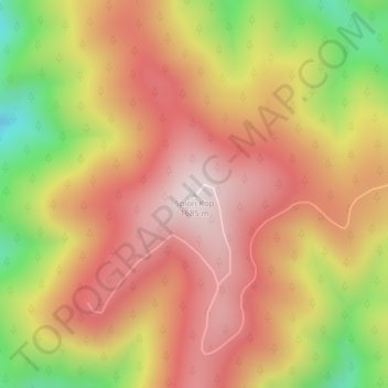
Name: Spion Kop topographic map, elevation, terrain.
Location: Spion Kop, Shoshone County, Idaho, United States (47.90487 -116.09078 47.90497 -116.09068)
Average elevation: 1,436 m
Minimum elevation: 1,079 m
Maximum elevation: 1,673 m
Other topographic maps
Click on a map to view its topography, its elevation and its terrain.
Bonneville County
Bonneville County, Idaho, United States
Average elevation: 1,963 m
Boise County
United States > Idaho > Boise County
Boise County, Idaho, United States
Average elevation: 1,655 m
Blackfoot
United States > Idaho > Bingham County > Blackfoot
Blackfoot, Bingham County, Idaho, United States
Average elevation: 1,371 m