
Thank you for supporting this site ❤️
Make a donation
Make a donation
Madya topographic map
Click on the map to display elevation.
Thank you for supporting this site ❤️
Make a donation
Make a donation
About this map
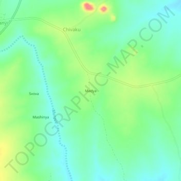
Name: Madya topographic map, elevation, terrain.
Location: Madya, Buhera, Manicaland Province, Zimbabwe (-19.19148 31.73860 -19.15148 31.77860)
Average elevation: 953 m
Minimum elevation: 924 m
Maximum elevation: 1,015 m
Thank you for supporting this site ❤️
Make a donation
Make a donation