
Thank you for supporting this site ❤️
Make a donation
Make a donation
Karasburg topographic map
Click on the map to display elevation.
Thank you for supporting this site ❤️
Make a donation
Make a donation
About this map
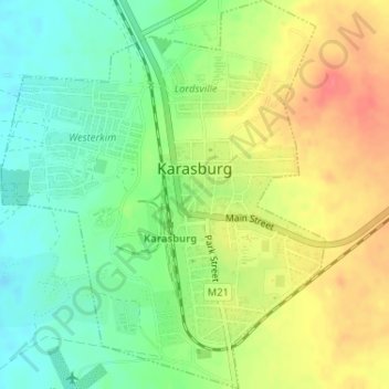
Name: Karasburg topographic map, elevation, terrain.
Location: Karasburg, Karas, 23008, Namibia (-28.02929 18.73257 -28.00085 18.75955)
Average elevation: 1,010 m
Minimum elevation: 982 m
Maximum elevation: 1,044 m
Thank you for supporting this site ❤️
Make a donation
Make a donation
Other topographic maps
Click on a map to view its topography, its elevation and its terrain.
Thank you for supporting this site ❤️
Make a donation
Make a donation
Thank you for supporting this site ❤️
Make a donation
Make a donation