
Thank you for supporting this site ❤️
Make a donation
Make a donation
Uvalde topographic map
Click on the map to display elevation.
Thank you for supporting this site ❤️
Make a donation
Make a donation
About this map
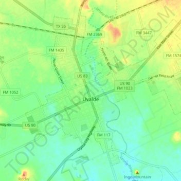
Name: Uvalde topographic map, elevation, terrain.
Location: Uvalde, Uvalde County, Texas, United States (29.18397 -99.81494 29.24162 -99.73534)
Average elevation: 280 m
Minimum elevation: 266 m
Maximum elevation: 301 m
Thank you for supporting this site ❤️
Make a donation
Make a donation