
Thank you for supporting this site ❤️
Make a donation
Make a donation
Poznań County topographic map
Click on the map to display elevation.
Thank you for supporting this site ❤️
Make a donation
Make a donation
About this map
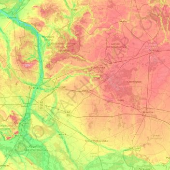
Name: Poznań County topographic map, elevation, terrain.
Location: Poznań County, Greater Poland Voivodeship, Poland (52.15160 16.45282 52.68046 17.39773)
Average elevation: 94 m
Minimum elevation: 44 m
Maximum elevation: 143 m
Thank you for supporting this site ❤️
Make a donation
Make a donation
Other topographic maps
Click on a map to view its topography, its elevation and its terrain.