
Mandach topographic map
Interactive map
Click on the map to display elevation.
About this map
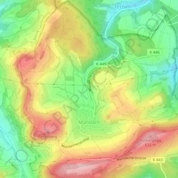
Name: Mandach topographic map, elevation, terrain.
Location: Mandach, Bezirk Brugg, Argovie, 5318, Suisse (47.53840 8.16972 47.56525 8.20793)
Average elevation: 517 m
Minimum elevation: 409 m
Maximum elevation: 636 m