
Gandullas topographic map
Interactive map
Click on the map to display elevation.
About this map
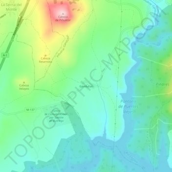
Name: Gandullas topographic map, elevation, terrain.
Average elevation: 1,017 m
Minimum elevation: 946 m
Maximum elevation: 1,216 m
Other topographic maps
Click on a map to view its topography, its elevation and its terrain.
Piñuécar-Gandullas
España > Comunidad de Madrid > Sierra Norte > Piñuécar-Gandullas
Piñuécar-Gandullas, Sierra Norte, Comunidad de Madrid, España
Average elevation: 1,114 m