
Ait Blal topographic map
Interactive map
Click on the map to display elevation.
About this map
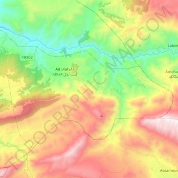
Name: Ait Blal topographic map, elevation, terrain.
Average elevation: 1,819 m
Minimum elevation: 1,055 m
Maximum elevation: 2,773 m
Other topographic maps
Click on a map to view its topography, its elevation and its terrain.
Imlil
Maroc > cercle d'Oultana > Imlil
Imlil, caïdat d'Imi-Nifri, cercle d'Oultana, Province d'Azilal, Béni Mellal-Khénifra, 22003, Maroc
Average elevation: 954 m