
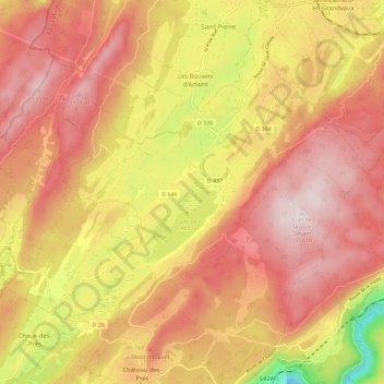
Grande-Rivière topographic map
Interactive map
Click on the map to display elevation.
About this map
Name: Grande-Rivière topographic map, elevation, terrain.
Average elevation: 947 m
Minimum elevation: 605 m
Maximum elevation: 1,154 m
Other topographic maps
Click on a map to view its topography, its elevation and its terrain.
Lac de l'Abbaye
France > Bourgogne-Franche-Comté > Jura > Grande-Rivière-Château > Grande-Rivière
Lac de l'Abbaye, Grande-Rivière, Grande-Rivière-Château, Saint-Claude, Jura, Bourgogne-Franche-Comté, France métropolitaine, 39150, France
Average elevation: 923 m