
Thank you for supporting this site ❤️
Make a donation
Make a donation
Hudson topographic map
Click on the map to display elevation.
Thank you for supporting this site ❤️
Make a donation
Make a donation
About this map
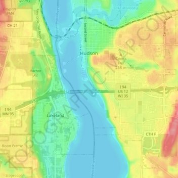
Name: Hudson topographic map, elevation, terrain.
Location: Hudson, Saint Croix County, Wisconsin, 54016, United States (44.93794 -92.77081 44.98918 -92.68940)
Average elevation: 242 m
Minimum elevation: 204 m
Maximum elevation: 302 m
Thank you for supporting this site ❤️
Make a donation
Make a donation
Other topographic maps
Click on a map to view its topography, its elevation and its terrain.