
Gurugram District topographic map
Interactive map
Click on the map to display elevation.
About this map
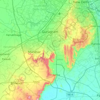
Name: Gurugram District topographic map, elevation, terrain.
Location: Gurugram District, Haryana, India (28.20057 76.65102 28.54090 77.22527)
Average elevation: 231 m
Minimum elevation: 188 m
Maximum elevation: 376 m
Other topographic maps
Click on a map to view its topography, its elevation and its terrain.