
Stakčín topographic map
Interactive map
Click on the map to display elevation.
About this map
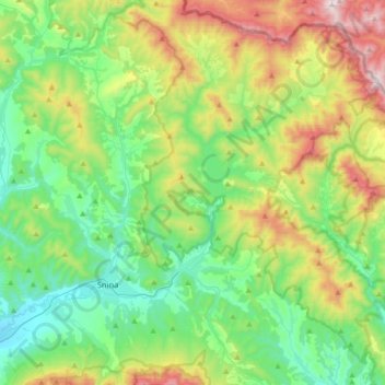
Name: Stakčín topographic map, elevation, terrain.
Average elevation: 471 m
Minimum elevation: 181 m
Maximum elevation: 1,147 m
The municipality lies in the Cirocha river valley, at an altitude of 257 metres and with a total area of 167.742 km2. According to the 2013 census it had a population of 2452 inhabitants. It lies between the Vihorlat and Bukovské vrchy mountains. The municipality is the seat of the Poloniny National Park governing body.