
Burnt Pond topographic map
Interactive map
Click on the map to display elevation.
About this map
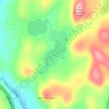
Name: Burnt Pond topographic map, elevation, terrain.
Average elevation: 324 m
Minimum elevation: 232 m
Maximum elevation: 442 m
Other topographic maps
Click on a map to view its topography, its elevation and its terrain.
Silver Bay
United States > New York > Warren County
Silver Bay, Town of Hague, Warren County, New York, 12874, United States
Average elevation: 218 m
Height of Land Mountain
United States > New York > Warren County > Town of Johnsburg
Height of Land Mountain, Town of Johnsburg, Warren County, New York, United States
Average elevation: 759 m
Diamond Point (hamlet)
United States > New York > Warren County > Town of Lake George
Diamond Point (hamlet), Town of Lake George, Warren County, New York, 12824, United States
Average elevation: 191 m
Town of Bolton
United States > New York > Warren County
Town of Bolton, Warren County, New York, United States
Average elevation: 297 m
Lake George
United States > New York > Warren County > Town of Bolton
Lake George, Town of Bolton, Warren County, New York, United States
Average elevation: 247 m