
Thank you for supporting this site ❤️
Make a donation
Make a donation
Helper topographic map
Click on the map to display elevation.
Thank you for supporting this site ❤️
Make a donation
Make a donation
About this map
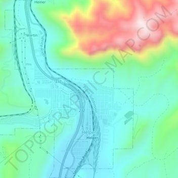
Name: Helper topographic map, elevation, terrain.
Location: Helper, Carbon County, Utah, United States (39.67569 -110.88073 39.70833 -110.84401)
Average elevation: 1,912 m
Minimum elevation: 1,763 m
Maximum elevation: 2,322 m
Thank you for supporting this site ❤️
Make a donation
Make a donation
Other topographic maps
Click on a map to view its topography, its elevation and its terrain.