
Mamaku Point topographic map
Interactive map
Click on the map to display elevation.
About this map
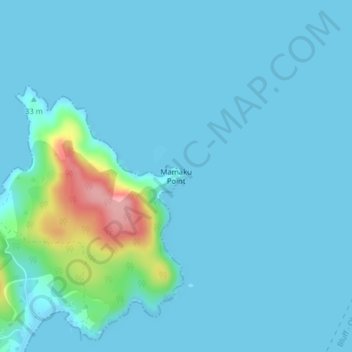
Name: Mamaku Point topographic map, elevation, terrain.
Average elevation: 14 m
Minimum elevation: 0 m
Maximum elevation: 126 m
Other topographic maps
Click on a map to view its topography, its elevation and its terrain.
Oban
New Zealand > Southland > Southland District > Stewart Island / Rakiura Community
Oban, Stewart Island / Rakiura Community, Southland District, Southland, 9818, New Zealand
Average elevation: 23 m