
Thank you for supporting this site ❤️
Make a donation
Make a donation
Rock Hall topographic map
Click on the map to display elevation.
Thank you for supporting this site ❤️
Make a donation
Make a donation
About this map
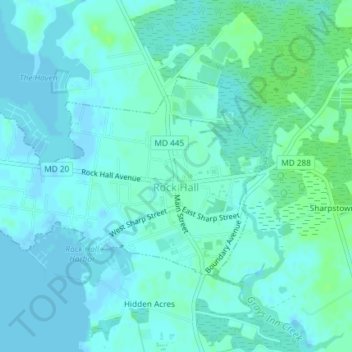
Name: Rock Hall topographic map, elevation, terrain.
Location: Rock Hall, Kent County, Maryland, 21661, United States (39.13094 -76.26220 39.14717 -76.22545)
Average elevation: 3 m
Minimum elevation: -2 m
Maximum elevation: 10 m
Thank you for supporting this site ❤️
Make a donation
Make a donation
Other topographic maps
Click on a map to view its topography, its elevation and its terrain.