
Cumes topographic map
Interactive map
Click on the map to display elevation.
About this map
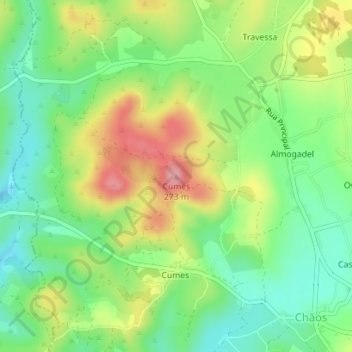
Name: Cumes topographic map, elevation, terrain.
Location: Cumes, Ferreira do Zêzere, Santarém, Centro, Portugal (39.71656 -8.41636 39.71666 -8.41626)
Average elevation: 190 m
Minimum elevation: 138 m
Maximum elevation: 267 m
Other topographic maps
Click on a map to view its topography, its elevation and its terrain.
São Paulo
Portugal > Centro > Ferreira do Zêzere > Beco
São Paulo, Ferreira do Zêzere, Santarém, Médio Tejo, Centro, 2240-612, Portugal
Average elevation: 220 m