
Albert Falls topographic map
Interactive map
Click on the map to display elevation.
About this map
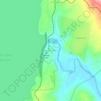
Name: Albert Falls topographic map, elevation, terrain.
Average elevation: 662 m
Minimum elevation: 615 m
Maximum elevation: 788 m
Other topographic maps
Click on a map to view its topography, its elevation and its terrain.
Albert Falls Dam
South Africa > KwaZulu-Natal > uMgungundlovu District Municipality > uMshwathi Local Municipality > Albert Falls
Average elevation: 653 m
Mpolweni
South Africa > KwaZulu-Natal > uMgungundlovu District Municipality > uMshwathi Local Municipality
Average elevation: 714 m