
Bahodopi topographic map
Interactive map
Click on the map to display elevation.
About this map
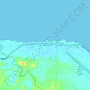
Name: Bahodopi topographic map, elevation, terrain.
Location: Bahodopi, Morowali, Central Sulawesi, Indonesia (-2.81000 122.10490 -2.77000 122.14490)
Average elevation: 4 m
Minimum elevation: -1 m
Maximum elevation: 26 m
Other topographic maps
Click on a map to view its topography, its elevation and its terrain.
Bente
Indonesia > Central Sulawesi > Morowali
Bente, Bungku Tengah, Morowali, Central Sulawesi, Sulawesi, Indonesia
Average elevation: 8 m