
Highgate Center topographic map
Interactive map
Click on the map to display elevation.
About this map
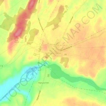
Name: Highgate Center topographic map, elevation, terrain.
Average elevation: 82 m
Minimum elevation: 28 m
Maximum elevation: 123 m
Other topographic maps
Click on a map to view its topography, its elevation and its terrain.
Highgate Springs
United States > Vermont > Franklin County > Highgate
Highgate Springs, Highgate, Franklin County, Vermont, 05460, United States
Average elevation: 38 m