
Wasquehal topographic map
Interactive map
Click on the map to display elevation.
About this map
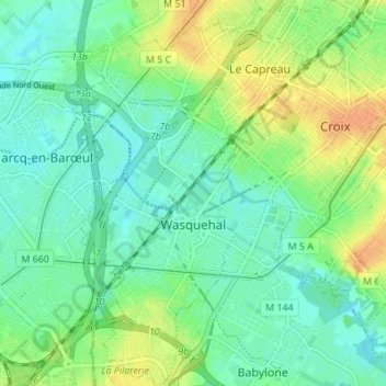
Name: Wasquehal topographic map, elevation, terrain.
Average elevation: 31 m
Minimum elevation: 18 m
Maximum elevation: 52 m
L'altitude minimum et maximum de Wasquehal sont respectivement de 18 et 47 mètres. La superficie de Wasquehal est de 6,86 km2 soit 686 hectares.