
Andrapengy topographic map
Interactive map
Click on the map to display elevation.
About this map
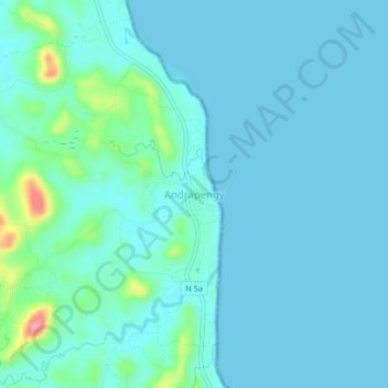
Name: Andrapengy topographic map, elevation, terrain.
Location: Andrapengy, Sava, Province d'Antsiranana, Madagascar (-14.69637 50.19621 -14.65637 50.23621)
Average elevation: 15 m
Minimum elevation: 0 m
Maximum elevation: 110 m