
Thank you for supporting this site ❤️
Make a donation
Make a donation
Leopold topographic map
Click on the map to display elevation.
Thank you for supporting this site ❤️
Make a donation
Make a donation
About this map
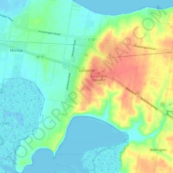
Name: Leopold topographic map, elevation, terrain.
Location: Leopold, Victoria, 3224, Australia (-38.23471 144.42185 -38.15815 144.50325)
Average elevation: 18 m
Minimum elevation: -3 m
Maximum elevation: 58 m
Thank you for supporting this site ❤️
Make a donation
Make a donation