
Thank you for supporting this site ❤️
Make a donation
Make a donation
Bakerton topographic map
Click on the map to display elevation.
Thank you for supporting this site ❤️
Make a donation
Make a donation
About this map
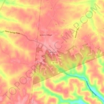
Name: Bakerton topographic map, elevation, terrain.
Location: Bakerton, Clay County, Tennessee, 37150, United States (36.49229 -85.82418 36.53229 -85.78418)
Average elevation: 284 m
Minimum elevation: 206 m
Maximum elevation: 314 m
Thank you for supporting this site ❤️
Make a donation
Make a donation